Aerial 3D Rendering Services
Photorealistic 3D renderings that showcase your project in full context to communicate scale, location, and impact with clarity.
Visualize Your Project from a New Perspective with 3D Aerial Renderings
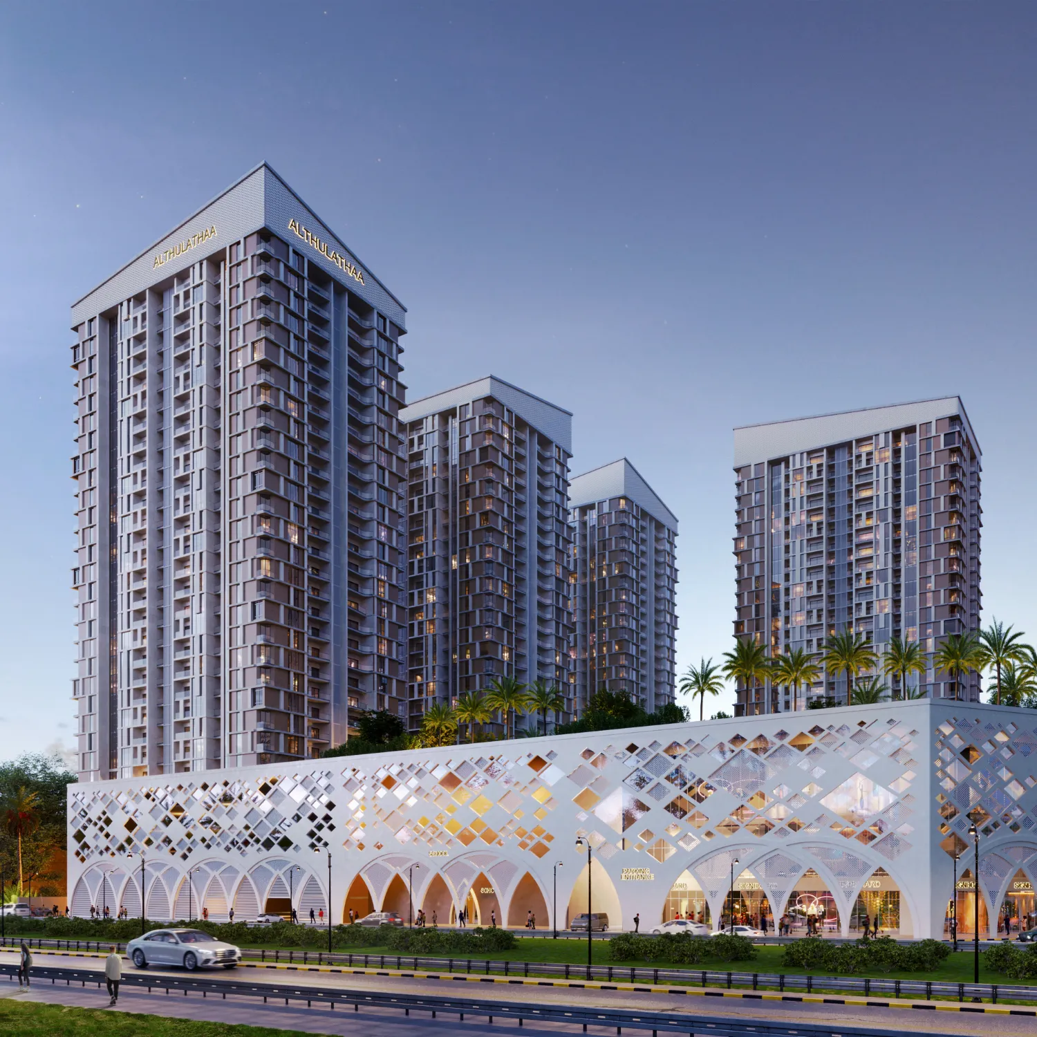
Aerial 3D rendering services allow you to present your project within its full environment—showing not just the building, but its surroundings, infrastructure, and spatial relationships. Instead of isolated visuals, stakeholders see the bigger picture, making it easier to understand scale, location, and real-world impact.
As an experienced aerial 3D rendering company, PIXREADY creates highly detailed bird’s-eye visuals for real estate developments, urban planning, commercial projects, and large-scale architectural concepts. Whether for approvals, investor presentations, or marketing campaigns, our 3D visuals transform technical data into clear, compelling visuals that support confident decision-making.
Benefits of Aerial 3D Rendering Service
Communicate Full Project Context
Aerial view renders show how your project fits into its real-world surroundings, including roads, neighboring buildings, landscaping, and infrastructure. This broader perspective helps stakeholders understand location advantages and spatial relationships instantly. It is especially valuable for large-scale developments where context is critical to decision-making.
Strengthen Investor Presentations
3D rendering makes complex developments easier to understand for investors and stakeholders. Clear visual overviews communicate scale, phasing, and project potential more effectively than drawings or maps. This clarity builds confidence and supports faster investment decisions.
Improve Planning and Approvals
Planning authorities often require clear visual context to evaluate developments. 3D aerial view rendering services provide accurate, realistic representations of how projects integrate into existing environments. This helps streamline approval processes by reducing ambiguity and improving communication with decision-makers.
Enhance Marketing and Pre-Sales
Each 3D render is a powerful marketing asset that showcases not only the property, but the lifestyle and location. This type of CGI highlights proximity to key landmarks, amenities, and infrastructure, making projects more attractive to buyers. Aerial 3D renders are widely used in brochures, websites, and digital campaigns to generate early interest, especially when developed in collaboration with a 3D advertising agency.
Support Large-Scale Design Development
For architects and developers, 3D aerial renderings help evaluate site planning, layout, and environmental integration. Seeing the project from above allows teams to refine design decisions, optimize land use, and identify potential issues early in the process, reducing costly revisions later.
Our 3D Aerial View Rendering Services
Still Aerial Renderings
High-resolution still aerial views provide a clear and comprehensive overview of your project and its surroundings. These visuals help stakeholders quickly understand layout, scale, and site context from a single image.
Oblique Aerial Perspectives
Oblique aerial perspectives combine elevated viewpoints with natural angles to create visually engaging and easy-to-understand images. These renders balance technical clarity with a more realistic viewing experience, helping audiences grasp both architectural design and environmental context in one cohesive visual.
Daytime & Sunset Views
Aerial view renderings in different lighting scenarios, including bright daytime and atmospheric sunset conditions. Day views highlight clarity, materials, and surroundings, while sunset visuals add mood and emotional appeal—perfect for marketing campaigns, presentations, and as an extension to hospitality rendering services.
Drone-Based Photomontages
By integrating CGI into existing drone photography, we produce highly realistic aerial visuals that accurately reflect the authentic environment. This approach combines the authenticity of real-world imagery with the flexibility of 3D rendering, making it ideal for developments where location context and accuracy are critical.
Flyover Animations
Dynamic flyover animations guide viewers across the project site, showcasing layout, infrastructure, and surroundings in motion. These animations are especially effective for presentations, marketing videos, and stakeholder communication, offering a cinematic overview that static images cannot achieve.
Phasing & Development Animations
Phasing animations illustrate how a project evolves over time, from initial groundwork to final completion. This solution helps communicate construction stages, timelines, and development strategy clearly as a valuable part of 3D real estate rendering service.
Discover our Aerial Rendering Visuals
Why Choose PIXREADY as Your Aerial View Rendering Studio?

Photorealistic Quality
As an expert architectural 3D rendering company, we deliver highly detailed 3D aerial renderings with accurate lighting, materials, and environmental context. Our visuals are designed to look natural and believable, ensuring your project is presented with maximum impact and professionalism.

Expertise in Large-Scale Developments
Our team has experience working with complex projects including residential communities, commercial developments, and masterplans. We understand how to visualize scale, infrastructure, and surroundings effectively.

Strategic Camera Composition
We carefully select camera angles that highlight key selling points, such as location advantages, accessibility, and surrounding amenities. Every aerial view is designed to communicate value clearly and effectively.

Fast Turnaround for Marketing Needs
We understand tight deadlines in real estate and development projects. Our production pipeline is optimized to deliver high-quality aerial renders quickly, helping you meet launch, presentation, and approval timelines.

Full-Service Production
As an aerial 3D visualization company, we handle the entire process—from modeling and environment creation to rendering and final delivery. This ensures consistency, efficiency, and a smooth workflow for every project.
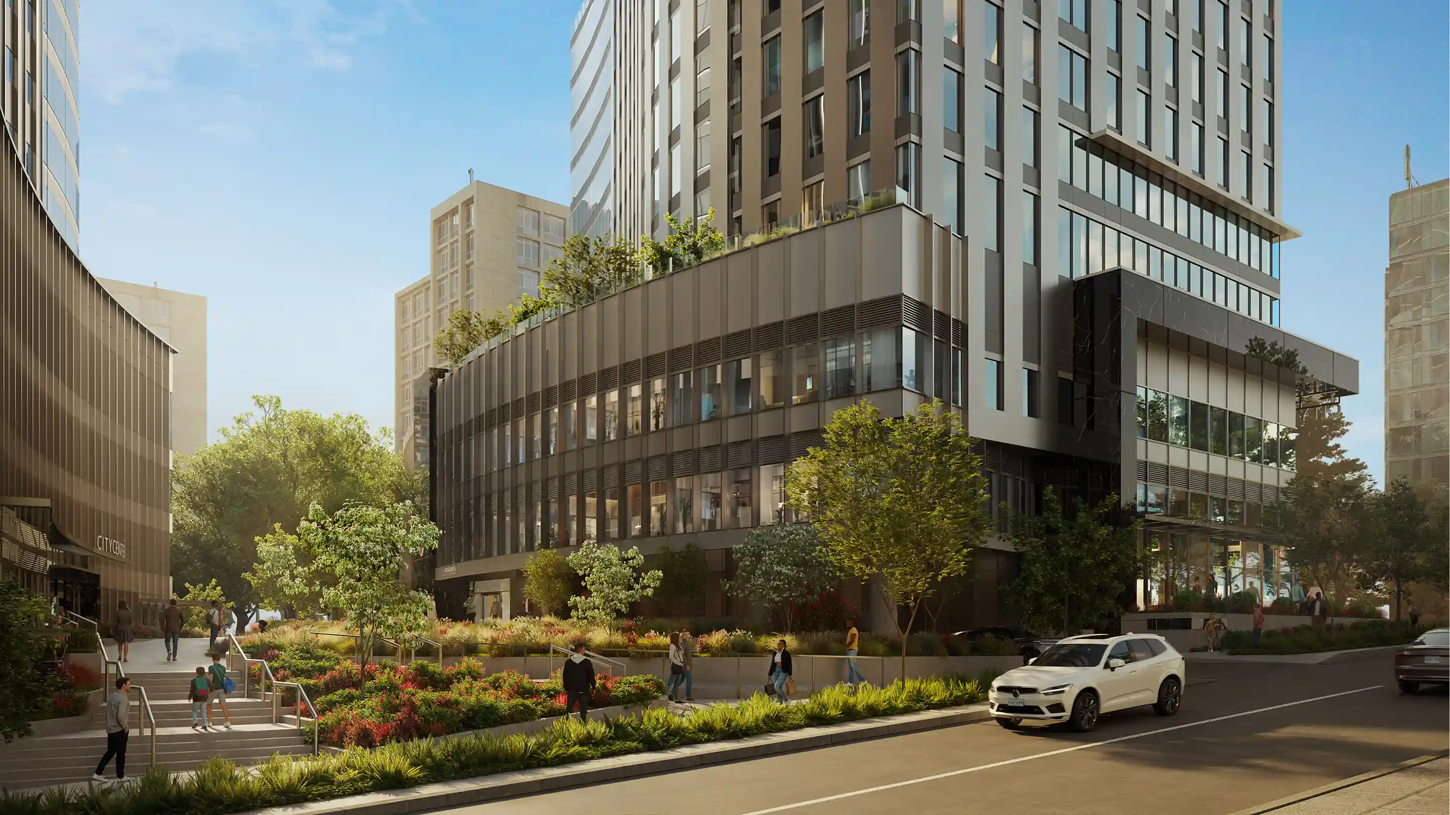
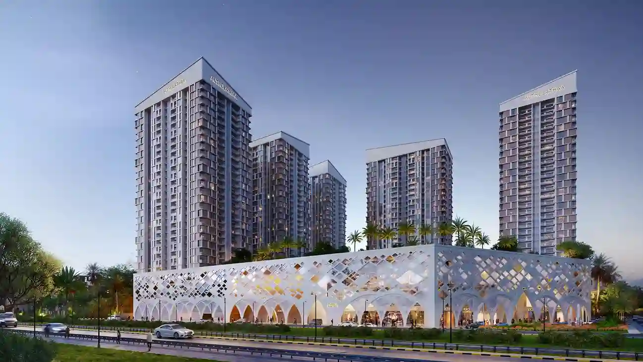
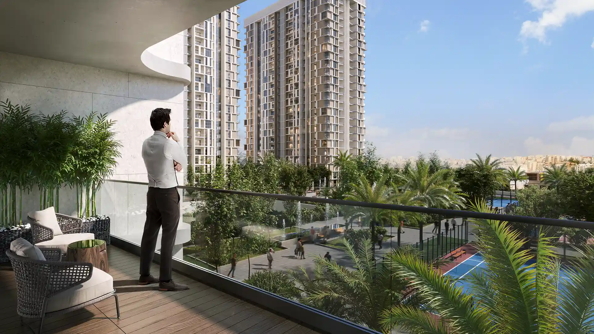
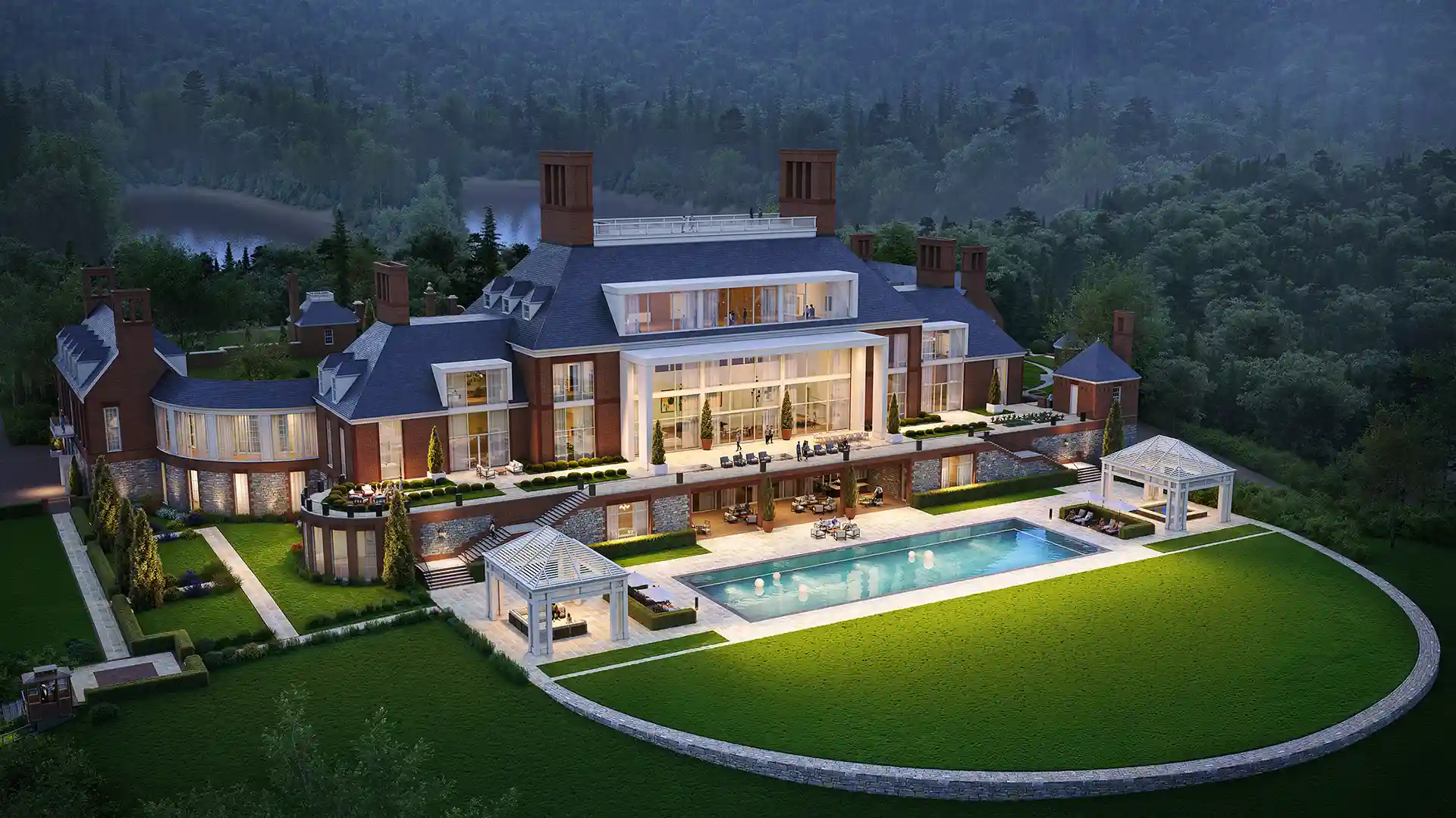
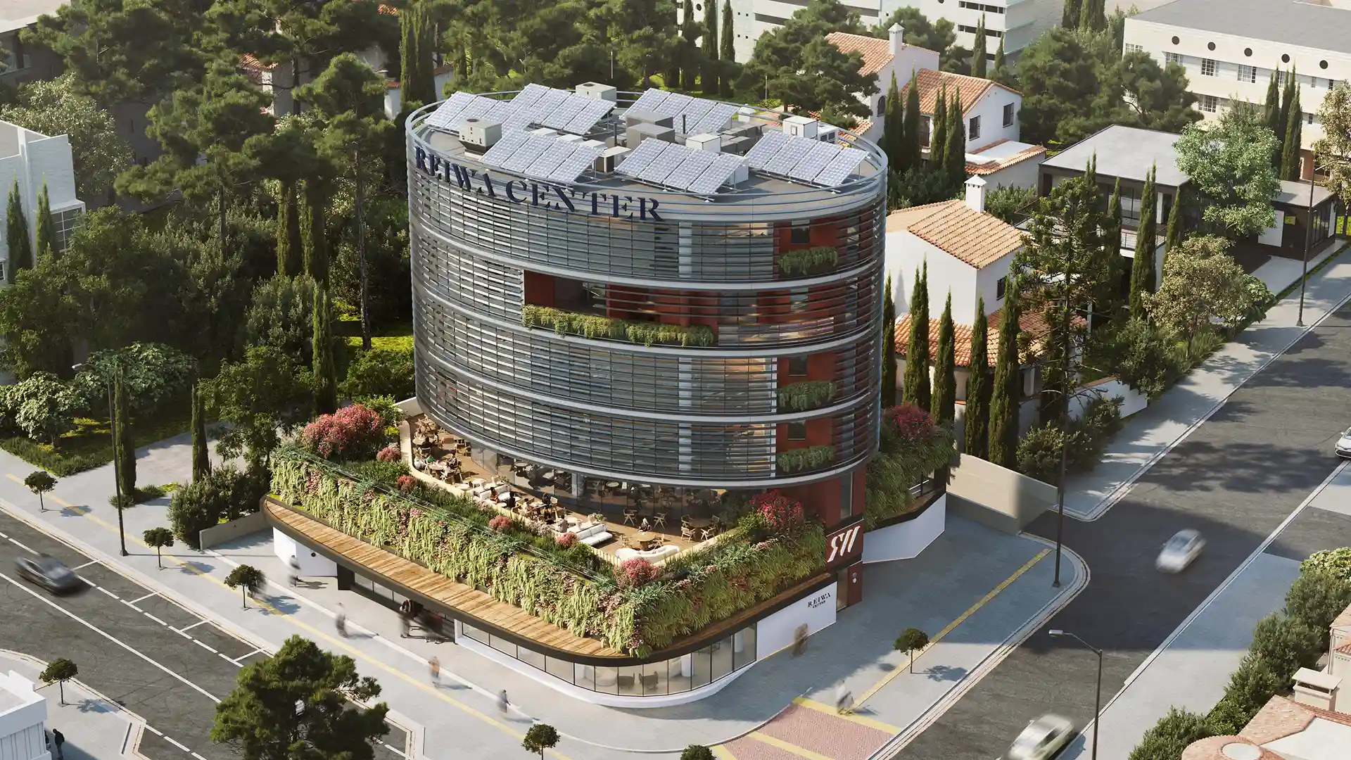
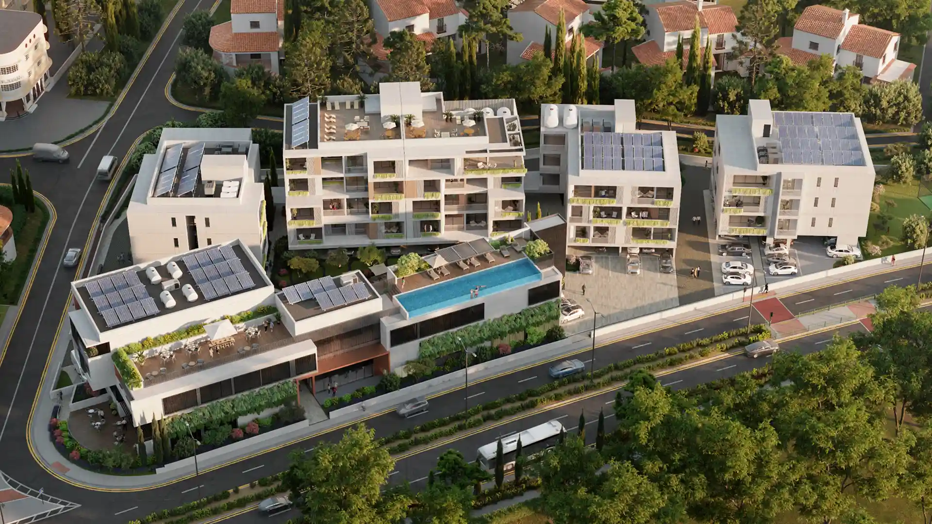
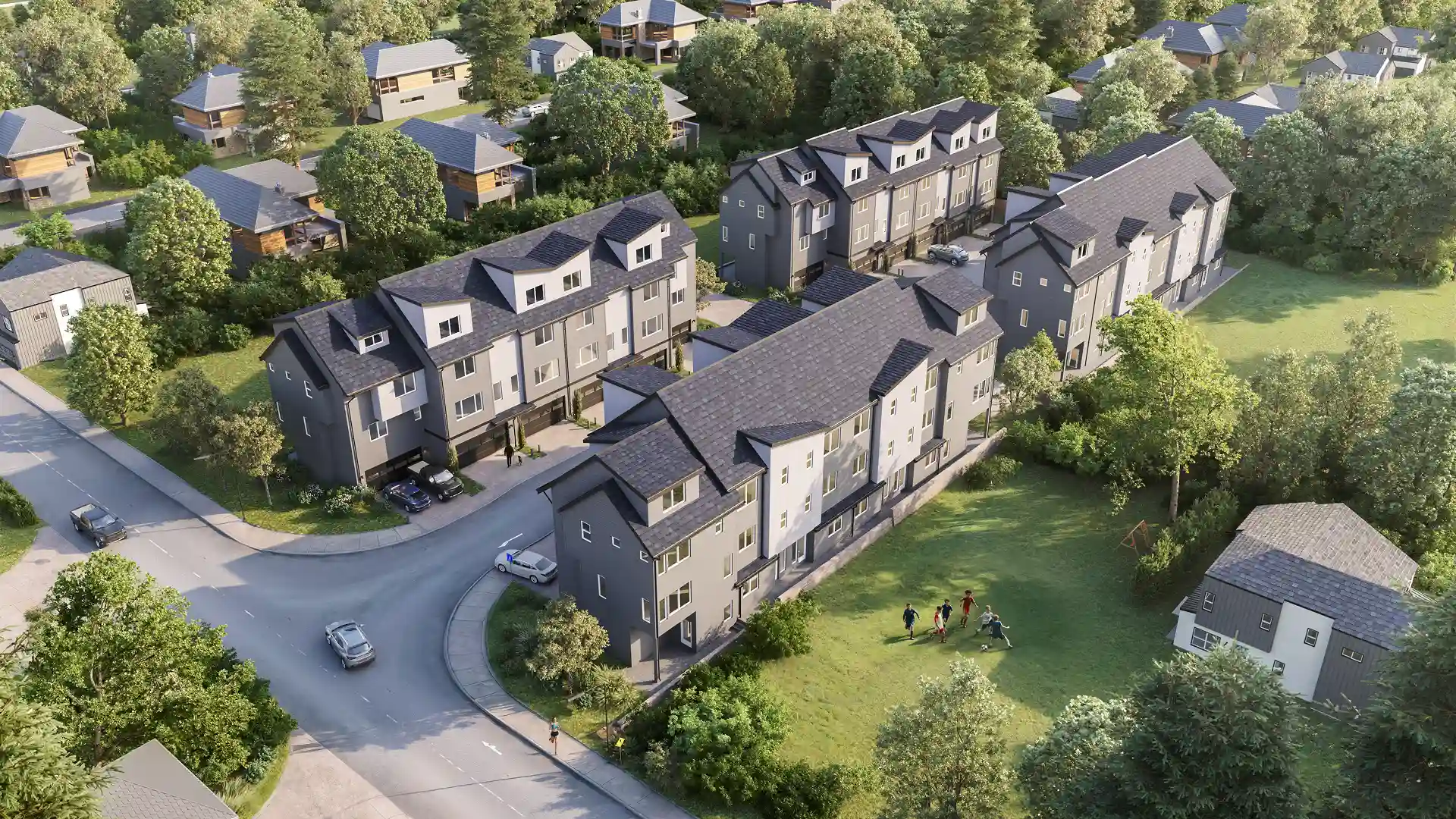
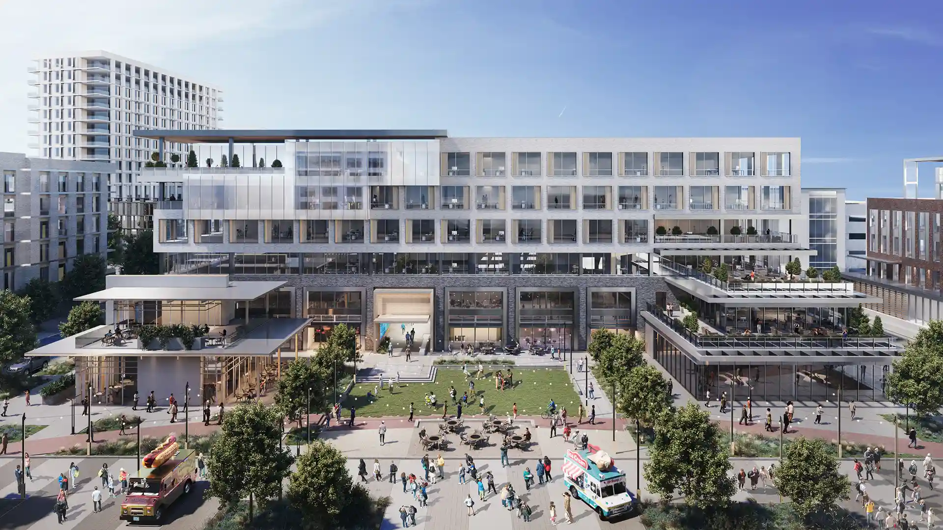
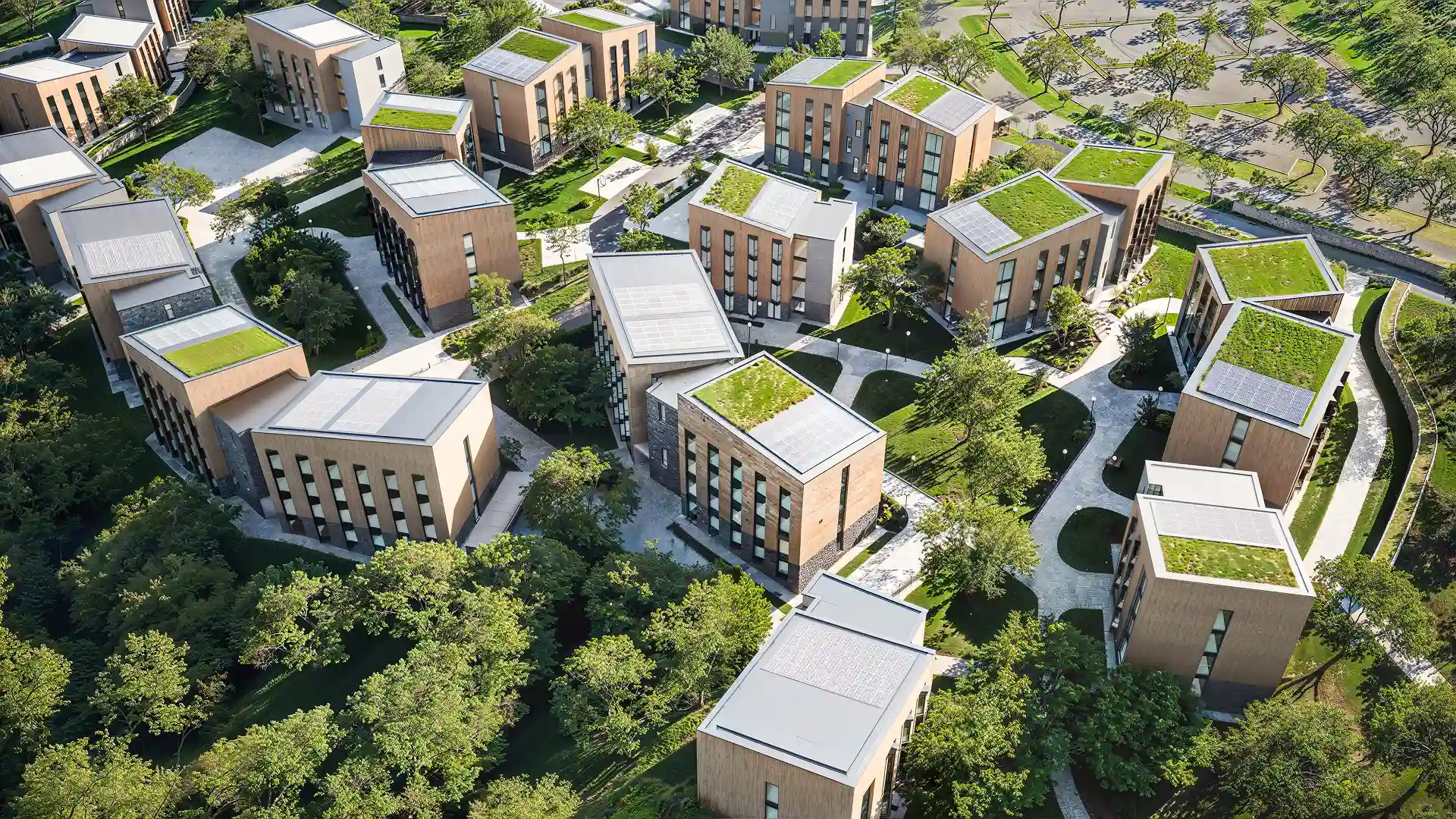
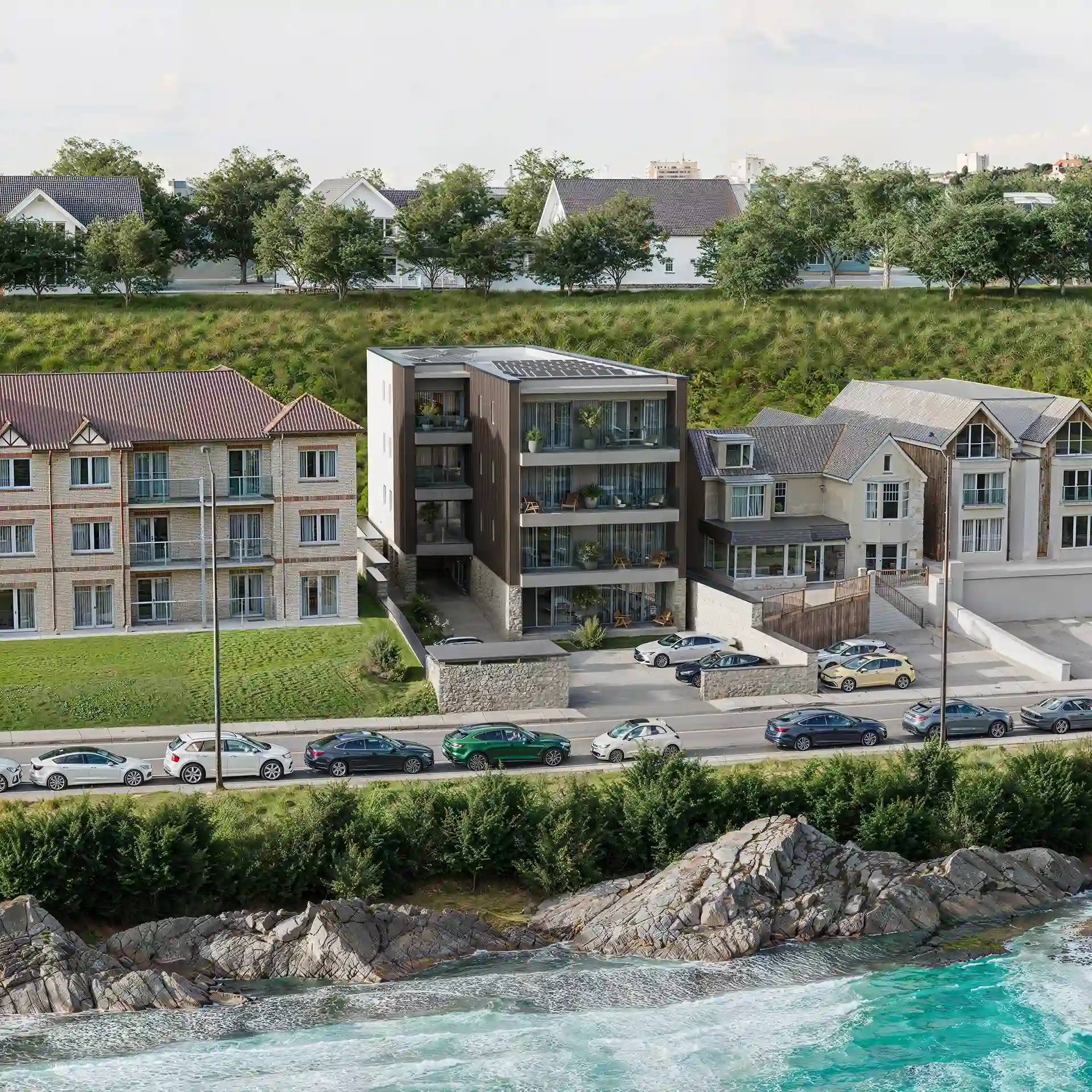
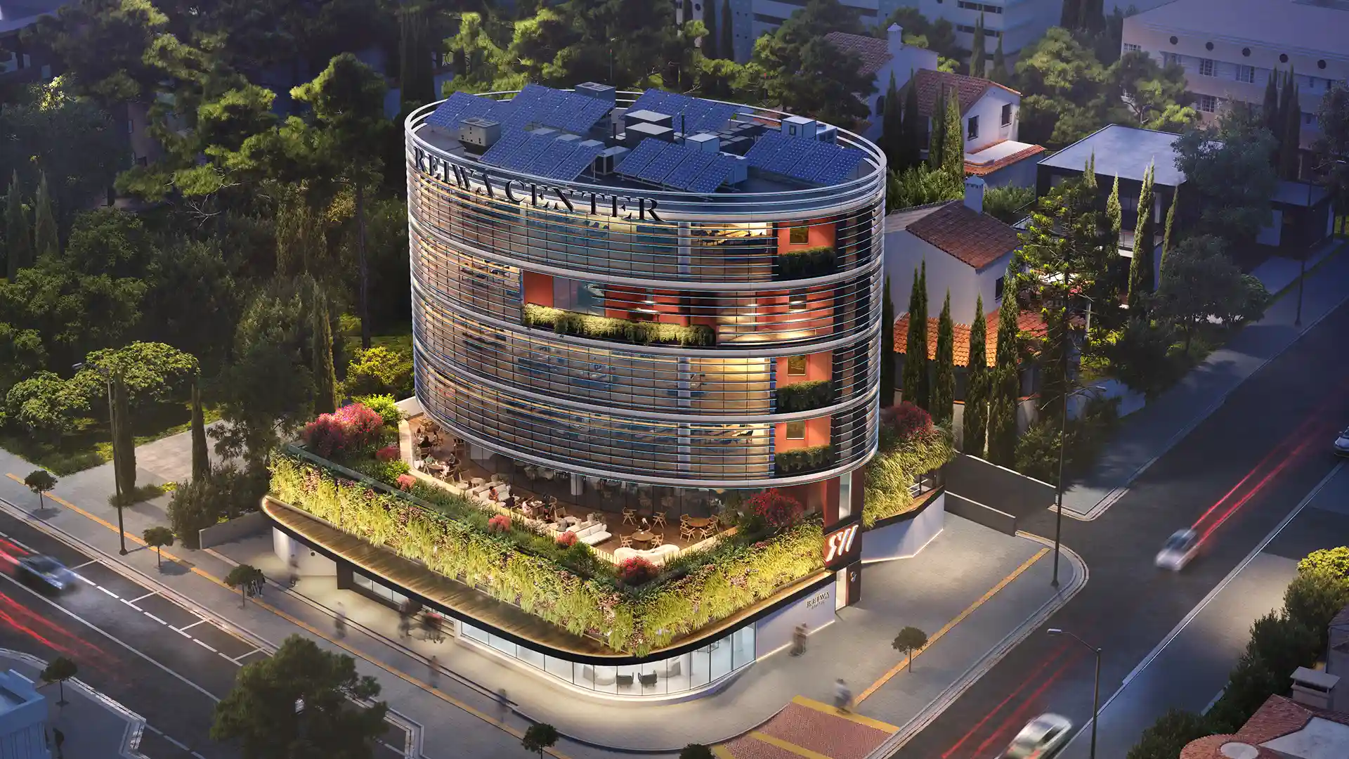
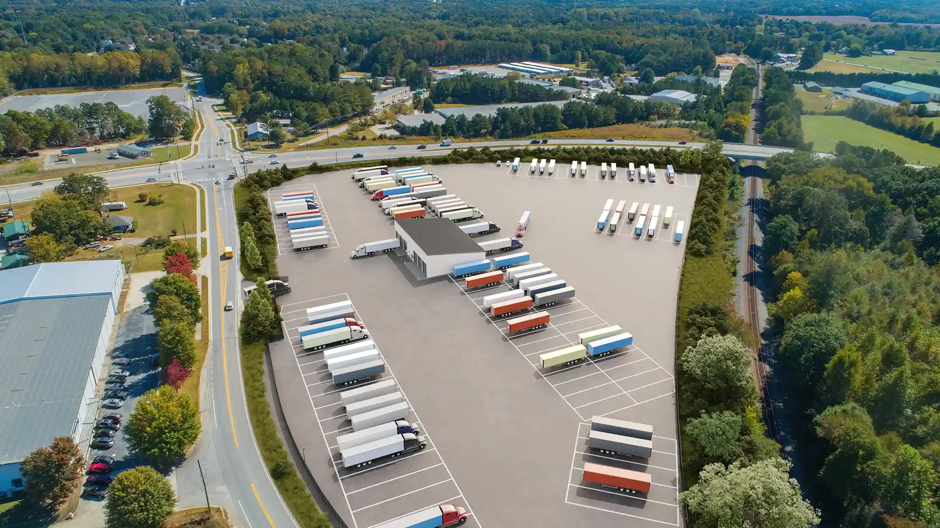
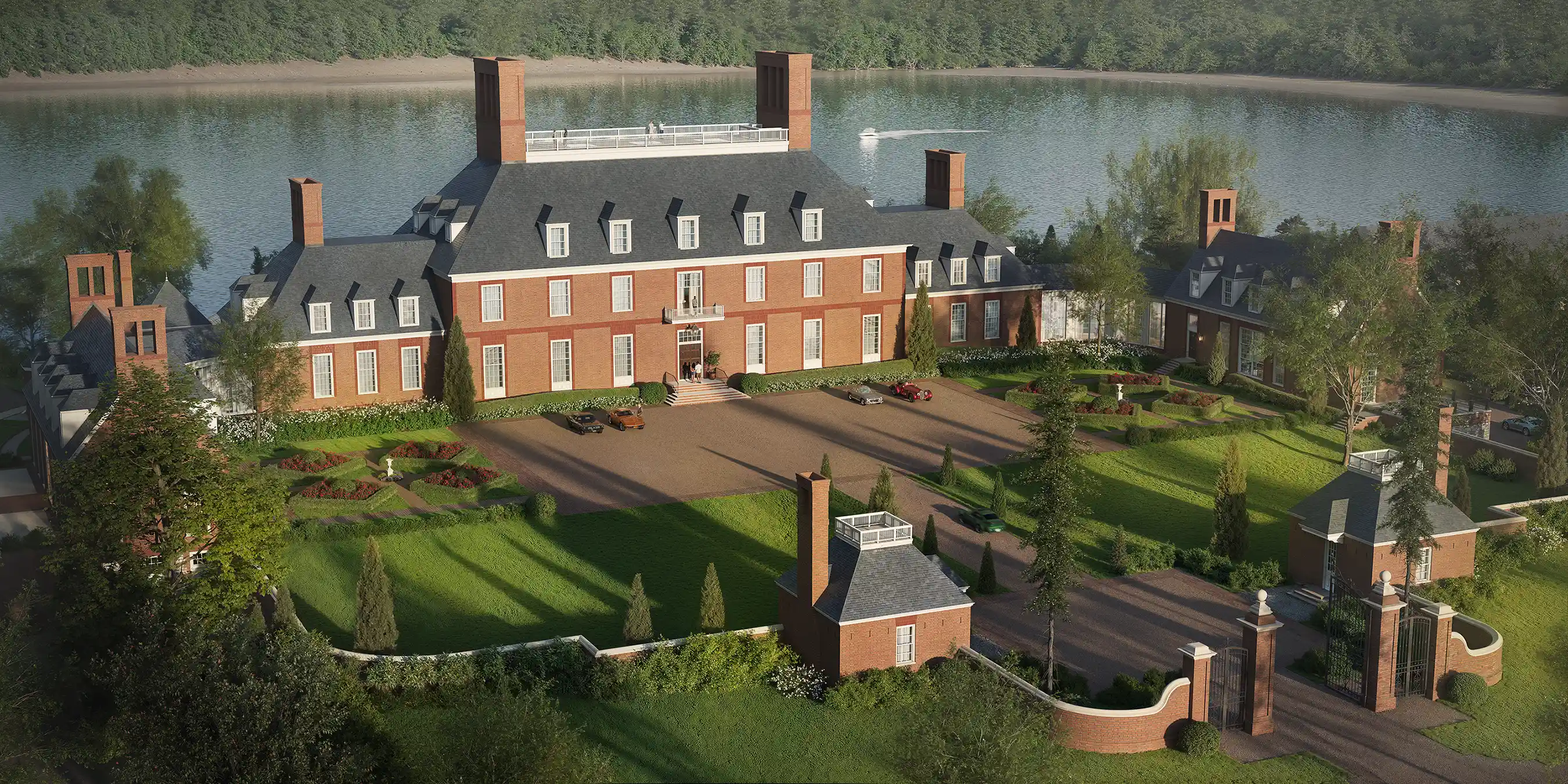
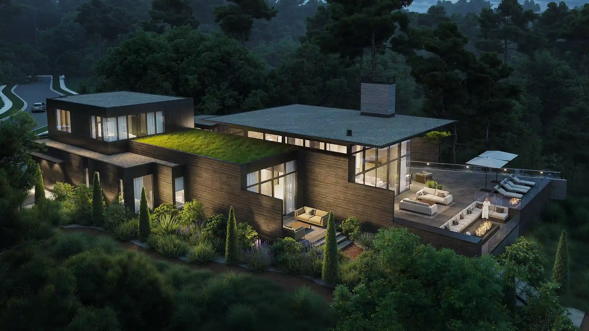
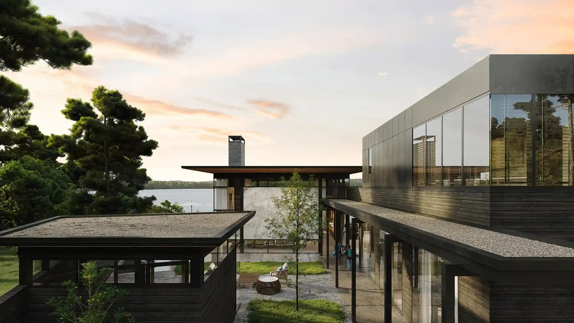
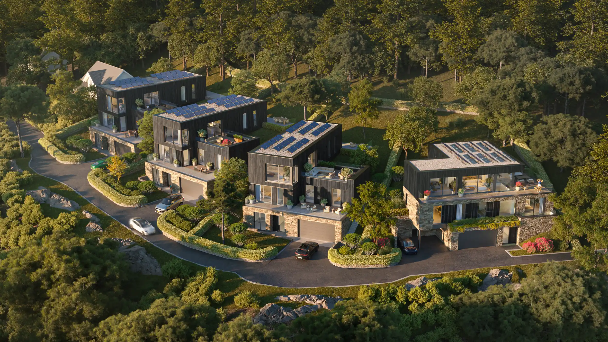
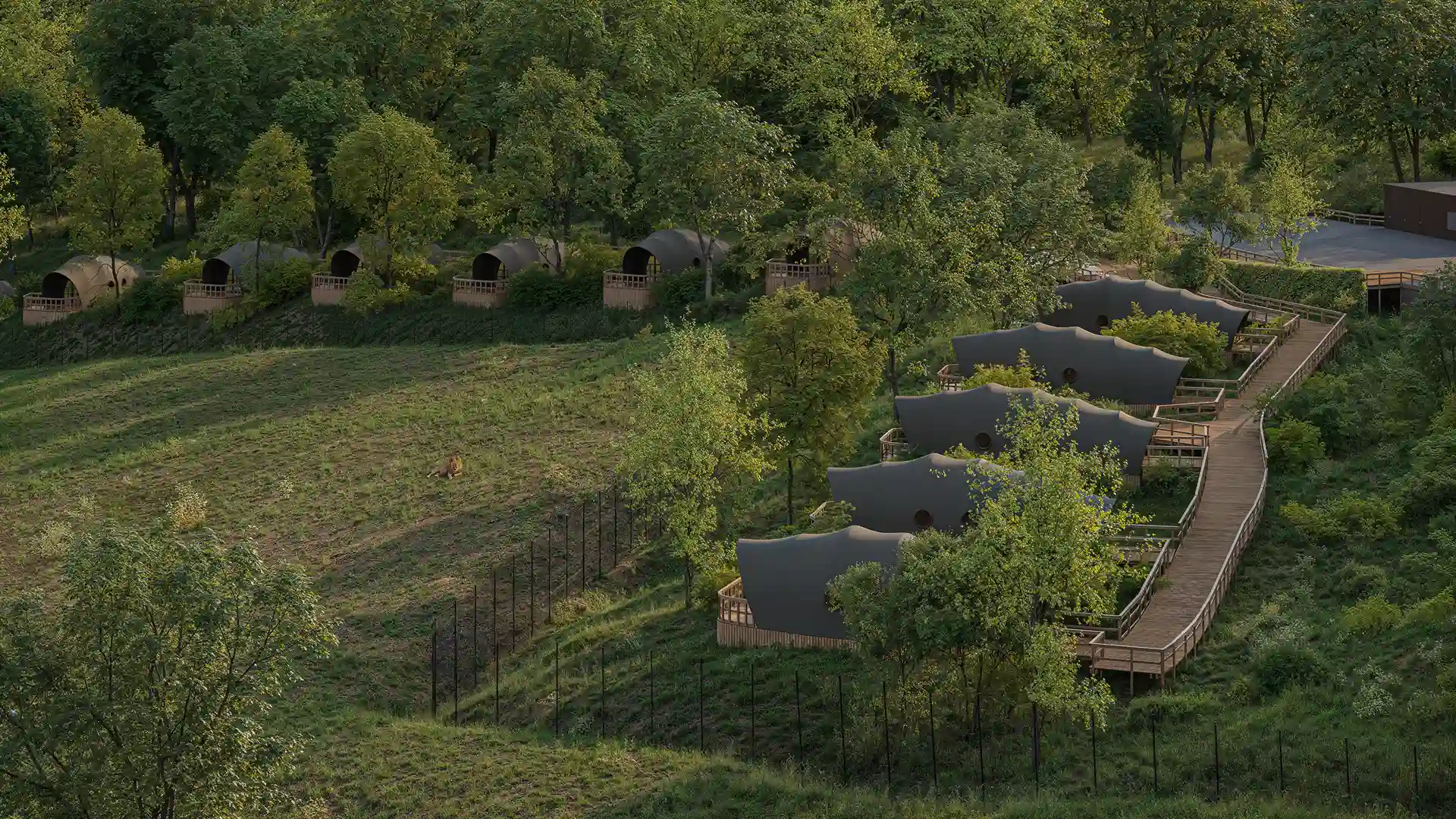
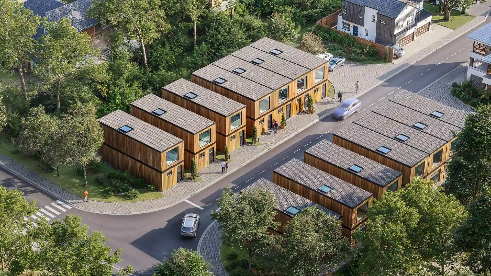
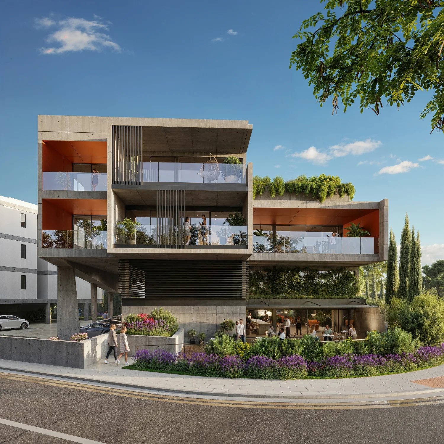
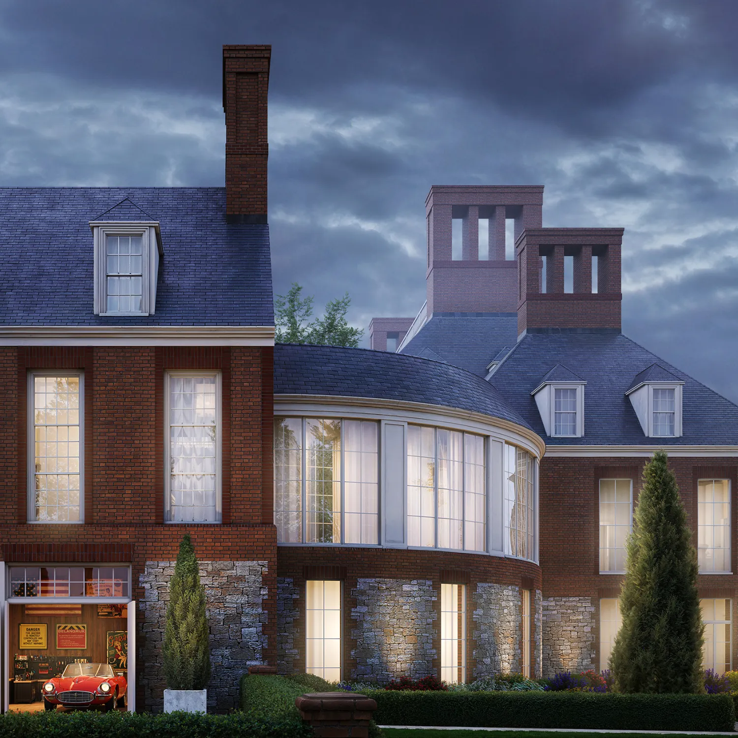
Our Aerial 3D Rendering Company Portfolio

.webp)
.jpg)
.webp)
%2520(1).png)
Project Brief & Data Collection
We gather site plans, CAD files, references, and project goals to define the scope and visualization approach.
3D Modeling & Environment Creation
Our team builds accurate models of buildings, terrain, infrastructure, and surroundings to reflect real-world context.
Camera Setup & Rendering
We define optimal aerial render viewpoints, lighting conditions, and composition to create visually compelling CGI.
Final Delivery & Optimization
After revisions, we deliver high-resolution visuals optimized for presentations, marketing, or digital platforms.
What Our Clients Say
"Great-quality visuals that fully met our expectations"
The team worked efficiently, respected all deadlines, and communication throughout the project was smooth and easy. The final renders became an important asset for presenting and promoting the Bronte development.
"Beautiful animations and renders"
I’ve been doing this a long time, and the PIXREADY team is very much at the top of the game.

“The overall quality of service was truly spectacular.”
PIXREADY helped us bring our visions to life and address all client feedback, resulting in a final product that was delivered efficiently and competently. We confidently recommend their services to anyone seeking top-tier 3D visualization solutions.
“We really enjoy working with the PIXREADY team”
The communication and collaboration are wonderful. We always know when the next round of renderings is coming, and the team picks up our comments excellently. We appreciate that we can jump on a quick call with the team to work through any questions. PIXREADY’s service helps bring our spaces to life for us to show our clients what the design of the project will look like with all the materials before construction.


“PIXREADY delivered outstanding 3D renderings with excellent service and communication”
The team was responsive, making revisions quickly and accurately. Their work helped us achieve our goals efficiently, and we are very proud of the final result.
“They’re professional, creative, and open to new ideas”
I highly recommend PIXREADY. My experience with them has been only positive—I received a world-class 3D animation product. They were enthusiastic about delivering quality work, finished on time with little input from me, and at a reasonable price. I will use them for any of my future developments.
FAQ
What do you need to start an aerial rendering project?
We typically need site plans, CAD drawings, references, or maps. As an aerial 3D rendering company, we can also work with limited data and guide you on required inputs to start efficiently.
How long does aerial view rendering take?
Most aerial 3D rendering services take 3–7 business days depending on complexity, level of detail, and number of views. We always confirm timelines upfront to match your deadlines.
What level of detail can be included in aerial view renders?
Our 3D visuals can include buildings, roads, landscaping, vehicles, people, and environmental details. The level of detail depends on project goals and required realism.
Can aerial view render be used for investor presentations?
Absolutely. 3D renderings are highly effective for investor presentations, as they clearly communicate scale, location, and development potential in a visually engaging format.
Elevate Your Project with Aerial 3D Rendering
Show your development in full context with high-quality aerial visuals that impress stakeholders and support smarter decisions. Work with a trusted aerial view rendering studio to turn complex projects into clear, compelling presentations.
.webp)